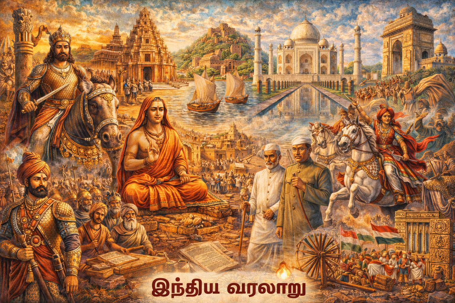
தலைப்பு
இந்தியாவின் இயற்கை பிரிவுகள்
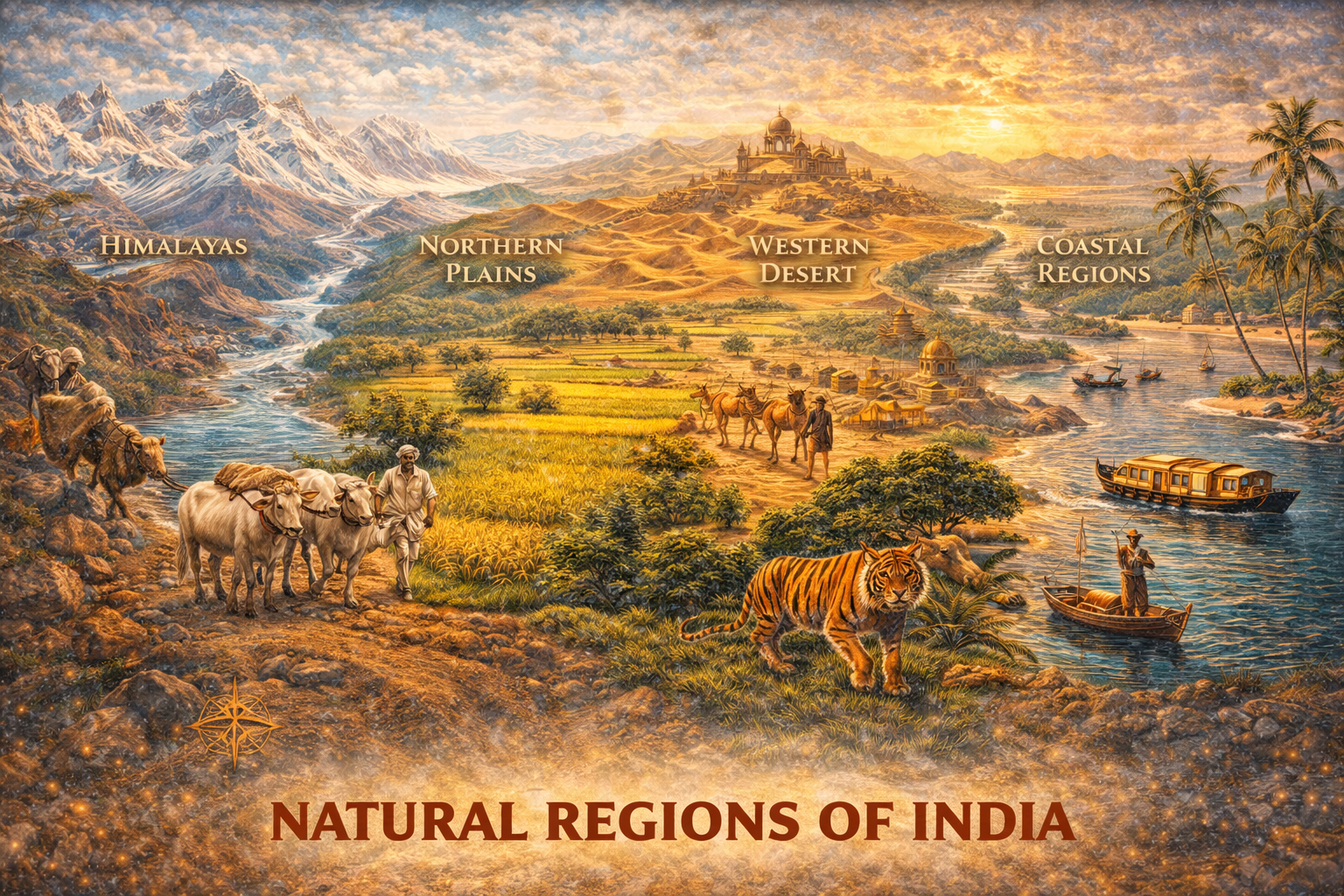
🌍 இந்தியாவின் இயற்கை பிரிவுகள் (Physiography of India) – முழு விளக்கம்
இந்தியாவின் நில அமைப்பு (Relief) பல்வேறு இயற்கை பிரிவுகளாகப் பிரிக்கப்பட்டுள்ளது. இவை புவியியல், காலநிலை, விவசாயம் மற்றும் மனித வாழ்வை பெரிதும் பாதிக்கின்றன.
📌 இந்தியாவின் முக்கிய இயற்கை பிரிவுகள்
- ✔ இமயமலை மலைத்தொடர் (Himalayan Mountains)
- ✔ வடக்கு சமவெளி (Northern Plains)
- ✔ தக்காண பீடபூமி (Peninsular Plateau)
- ✔ கடற்கரை சமவெளி (Coastal Plains)
- ✔ தீவுகள் (Islands)
🏔️ 1. இமயமலை மலைத்தொடர்
- ✔ உலகின் உயரமான மலைத்தொடர்
- ✔ வட இந்திய எல்லையை உருவாக்குகிறது
- ✔ முக்கிய நதிகளின் தோற்றம் (Ganga, Brahmaputra)
- ✔ குளிர் காலநிலையை உருவாக்க உதவும்
🌾 2. வடக்கு சமவெளி
- ✔ கங்கை, யமுனா, பிரம்மபுத்திரா நதிகள் அமைத்த சமவெளி
- ✔ மிக வளமான மண் (Alluvial Soil)
- ✔ விவசாயத்திற்கு உகந்த பகுதி
⛰️ 3. தக்காண பீடபூமி
- ✔ இந்தியாவின் பழமையான நிலப்பரப்பு
- ✔ கனிம வளங்கள் அதிகம்
- ✔ மேற்கு மற்றும் கிழக்கு தொடர்ச்சி மலைகள் சூழ்ந்துள்ளது
🌊 4. கடற்கரை சமவெளி
- ✔ கிழக்கு மற்றும் மேற்குக் கடற்கரை பகுதிகள்
- ✔ மீன்பிடி மற்றும் வர்த்தகத்திற்கு முக்கியம்
- ✔ துறைமுகங்கள் (Ports) அதிகம்
🏝️ 5. தீவுகள்
- ✔ அந்தமான் & நிக்கோபார் தீவுகள் (Bay of Bengal)
- ✔ லக்ஷத்வீப் தீவுகள் (Arabian Sea)
🌏 முக்கியத்துவம்
- ✔ காலநிலையை தீர்மானிக்கிறது
- ✔ விவசாய வளர்ச்சியை பாதிக்கிறது
- ✔ இயற்கை வளங்களை வழங்குகிறது
- ✔ மனித வாழ்வின் அமைப்பை தீர்மானிக்கிறது
முக்கிய குறிப்புகள் (TNPSC):
- ✔ 5 Physiographic divisions
- ✔ Himalayas – North
- ✔ Northern Plains – Fertile
- ✔ Plateau – Minerals
- ✔ Coastal + Islands
TNPSC தேர்வுகளில் “இந்தியாவின் இயற்கை பிரிவுகள் என்ன?” என்ற கேள்வி மிகவும் முக்கியமானது.
🏔️ இந்தியாவின் மலைத்தொடர்கள் (Mountain Ranges of India) – முழு விளக்கம்
இந்தியாவின் புவியியல் அமைப்பில் மலைத்தொடர்கள் மிக முக்கிய பங்கு வகிக்கின்றன. இவை காலநிலை, நதிகள், மழை மற்றும் இயற்கை வளங்களை தீர்மானிக்கின்றன.
📌 முக்கிய மலைத்தொடர்கள்
- ✔ இமயமலை (Himalayas)
- ✔ அரவல்லி மலைத்தொடர் (Aravalli Range)
- ✔ விண்ட்யா மலைத்தொடர் (Vindhya Range)
- ✔ சத்புரா மலைத்தொடர் (Satpura Range)
- ✔ மேற்கு தொடர்ச்சி மலை (Western Ghats)
- ✔ கிழக்கு தொடர்ச்சி மலை (Eastern Ghats)
🏔️ 1. இமயமலை (Himalayas)
- ✔ உலகின் உயரமான மலைத்தொடர்
- ✔ வட இந்திய எல்லையை உருவாக்குகிறது
- ✔ கங்கை, பிரம்மபுத்திரா போன்ற நதிகளின் தோற்றம்
- ✔ இந்தியாவை குளிர் காற்றிலிருந்து பாதுகாக்கிறது
⛰️ 2. அரவல்லி மலைத்தொடர்
- ✔ இந்தியாவின் பழமையான மலைத்தொடர்
- ✔ ராஜஸ்தான் பகுதியில் அமைந்துள்ளது
🏞️ 3. விண்ட்யா மலைத்தொடர்
- ✔ வட மற்றும் தென் இந்தியாவை பிரிக்கிறது
- ✔ மத்திய இந்தியாவில் உள்ளது
🌄 4. சத்புரா மலைத்தொடர்
- ✔ விண்ட்யா மலைத்தொடருக்கு தெற்கில் அமைந்துள்ளது
- ✔ நர்மதா நதி இடையில் ஓடுகிறது
🌿 5. மேற்கு தொடர்ச்சி மலை (Western Ghats)
- ✔ அரபிக்கடல் அருகே அமைந்துள்ளது
- ✔ அதிக மழை பெறும் பகுதி
- ✔ உயிரின வளம் (Biodiversity) அதிகம்
🌳 6. கிழக்கு தொடர்ச்சி மலை (Eastern Ghats)
- ✔ வங்காள விரிகுடா அருகே அமைந்துள்ளது
- ✔ இடைவெளிகள் (discontinuous ranges) உள்ளது
🌏 முக்கியத்துவம்
- ✔ மழை மற்றும் காலநிலையை தீர்மானிக்கிறது
- ✔ நதிகளின் தோற்றம் மலைப்பகுதிகளில் உள்ளது
- ✔ இயற்கை வளங்கள் மற்றும் வன வளம் அதிகம்
- ✔ சுற்றுலா மற்றும் உயிரின பல்வகைமைக்கு முக்கியம்
முக்கிய குறிப்புகள் (TNPSC):
- ✔ Himalayas – Highest
- ✔ Aravalli – Oldest
- ✔ Vindhya – Divides North & South
- ✔ Western Ghats – Heavy Rain
- ✔ Eastern Ghats – Discontinuous
TNPSC தேர்வுகளில் “இந்தியாவின் மலைத்தொடர்கள் என்ன?” “மேற்கு தொடர்ச்சி மலை முக்கியத்துவம் என்ன?” போன்ற கேள்விகள் கேட்கப்படுகின்றன.
🌊 இந்தியாவின் ஆறுகள் (Rivers of India) – முழு விளக்கம்
இந்தியாவின் ஆறுகள் நாட்டின் உயிர்நாடியாகக் கருதப்படுகின்றன. இவை குடிநீர், விவசாயம், மின்சாரம் மற்றும் போக்குவரத்துக்கு மிகவும் முக்கியமானவை.
📌 இந்தியாவின் ஆறுகள் – வகைகள்
- ✔ இமயமலை ஆறுகள் (Himalayan Rivers)
- ✔ தீபகற்ப ஆறுகள் (Peninsular Rivers)
🏔️ 1. இமயமலை ஆறுகள்
- ✔ பனிமலை (Glacier) மூலம் தோன்றுகின்றன
- ✔ ஆண்டு முழுவதும் நீர் ஓட்டம் (Perennial)
- ✔ மிகப்பெரிய மற்றும் நீளமான ஆறுகள்
முக்கிய ஆறுகள்
- ✔ கங்கை (Ganga)
- ✔ யமுனை (Yamuna)
- ✔ பிரம்மபுத்திரா (Brahmaputra)
⛰️ 2. தீபகற்ப ஆறுகள்
- ✔ மழை சார்ந்த ஆறுகள்
- ✔ காலாண்டு ஓட்டம் (Seasonal)
- ✔ குறைந்த நீளம்
முக்கிய ஆறுகள்
- ✔ நர்மதா (Narmada)
- ✔ தாப்தி (Tapti)
- ✔ கோதாவரி (Godavari)
- ✔ கிருஷ்ணா (Krishna)
- ✔ காவிரி (Cauvery)
🌍 ஆறுகளின் முக்கியத்துவம்
- ✔ குடிநீர் வழங்குகிறது
- ✔ விவசாயத்திற்கு உதவுகிறது
- ✔ நீர்மின் உற்பத்தி
- ✔ போக்குவரத்து மற்றும் வர்த்தகம்
⚠️ சிக்கல்கள்
- ✔ நீர் மாசுபாடு
- ✔ வெள்ளப்பெருக்கு
- ✔ நீர் பற்றாக்குறை
முக்கிய குறிப்புகள் (TNPSC):
- ✔ Himalayan Rivers – Perennial
- ✔ Peninsular Rivers – Seasonal
- ✔ Ganga – Longest
- ✔ Godavari – Longest Peninsular River
TNPSC தேர்வுகளில் “இந்தியாவின் ஆறுகள் வகைகள் என்ன?”, “கங்கை எங்கு தோன்றுகிறது?” போன்ற கேள்விகள் கேட்கப்படுகின்றன.
🌾 சமவெளிகள் (Plains of India) – முழு விளக்கம்
சமவெளிகள் என்பது உயரம் குறைவாகவும் சமமாகவும் காணப்படும் நிலப்பகுதிகளாகும். இந்தியாவில் சமவெளிகள் விவசாயம், குடியிருப்பு மற்றும் நாகரிக வளர்ச்சிக்கு மிகவும் உகந்த பகுதிகளாக உள்ளன.
📌 இந்தியாவின் சமவெளிகள் – வகைகள்
- ✔ வடக்கு சமவெளி (Northern Plains)
- ✔ கடற்கரை சமவெளி (Coastal Plains)
🌾 1. வடக்கு சமவெளி (Northern Plains)
- ✔ கங்கை, யமுனை, பிரம்மபுத்திரா நதிகள் அமைத்த சமவெளி
- ✔ மிக வளமான மண் (Alluvial Soil)
- ✔ இந்தியாவின் முக்கிய விவசாய பகுதி
- ✔ மக்கள் தொகை அதிகம்
📍 பகுதிகள்
- ✔ பஞ்சாப் சமவெளி
- ✔ கங்கை சமவெளி
- ✔ பிரம்மபுத்திரா சமவெளி
🌊 2. கடற்கரை சமவெளி (Coastal Plains)
- ✔ இந்தியாவின் கிழக்கு மற்றும் மேற்குக் கடற்கரை பகுதிகள்
- ✔ மீன்பிடி மற்றும் துறைமுகங்களுக்கு முக்கியம்
📍 வகைகள்
- ✔ மேற்கு கடற்கரை (Arabian Sea side)
- ✔ கிழக்கு கடற்கரை (Bay of Bengal side)
🌏 முக்கியத்துவம்
- ✔ விவசாயத்திற்கு மிகவும் உகந்த நிலம்
- ✔ நகர வளர்ச்சி அதிகம்
- ✔ போக்குவரத்து வசதி எளிது
- ✔ மக்கள் வாழ்வுக்கு உகந்த சூழல்
முக்கிய குறிப்புகள் (TNPSC):
- ✔ Northern Plains – Fertile
- ✔ Formed by rivers
- ✔ Coastal Plains – Ports & Fishing
- ✔ High population density
TNPSC தேர்வுகளில் “சமவெளிகள் என்ன?”, “வடக்கு சமவெளியின் முக்கியத்துவம் என்ன?” போன்ற கேள்விகள் கேட்கப்படுகின்றன.
⛰️ பீடபூமிகள் (Plateaus of India) – முழு விளக்கம்
பீடபூமி என்பது சுற்றுப்புற நிலப்பரப்பை விட உயரமாகவும், மேற்பரப்பு சமமாகவும் காணப்படும் நில அமைப்பாகும். இந்தியாவில் பீடபூமிகள் மிகவும் பழமையான நிலப்பரப்புகளாகும்.
📌 இந்தியாவின் முக்கிய பீடபூமிகள்
- ✔ தக்காண பீடபூமி (Peninsular Plateau)
- ✔ மத்திய உயர்நிலப் பகுதி (Central Highlands)
- ✔ டெக்கான் பீடபூமி (Deccan Plateau)
⛰️ 1. தக்காண பீடபூமி
- ✔ இந்தியாவின் மிகப் பழமையான நிலப்பகுதி
- ✔ கனிம வளங்கள் (Minerals) அதிகம்
- ✔ மேற்கு மற்றும் கிழக்கு தொடர்ச்சி மலைகள் சூழ்ந்துள்ளது
🏞️ 2. மத்திய உயர்நிலப் பகுதி
- ✔ விண்ட்யா மற்றும் அரவல்லி மலைகள் இடையில் அமைந்துள்ளது
- ✔ மலவா பீடபூமி (Malwa Plateau) இதில் அடங்கும்
🌄 3. டெக்கான் பீடபூமி
- ✔ தென் இந்தியாவில் பரவலாக உள்ளது
- ✔ லாவா (lava) மூலம் உருவானது
- ✔ கரிமண் (Black Soil) காணப்படும்
🌍 முக்கிய அம்சங்கள்
- ✔ பழமையான கன்மலைகள்
- ✔ கனிம வளங்கள் (Iron, Coal, Mica)
- ✔ நதிகள் – நர்மதா, தாப்தி போன்றவை
🌏 முக்கியத்துவம்
- ✔ தொழில்களுக்கு தேவையான கனிம வளங்கள்
- ✔ விவசாயத்திற்கு சில பகுதிகள் உகந்தவை
- ✔ நீர்வீழ்ச்சிகள் மற்றும் சுற்றுலா
முக்கிய குறிப்புகள் (TNPSC):
- ✔ Oldest landmass
- ✔ Rich in minerals
- ✔ Deccan Plateau – Lava origin
- ✔ Black soil region
TNPSC தேர்வுகளில் “பீடபூமி என்றால் என்ன?”, “டெக்கான் பீடபூமியின் அம்சங்கள் என்ன?” போன்ற கேள்விகள் கேட்கப்படுகின்றன.
மக்கள் கேட்கும் கேள்விகள்
உங்களுக்கான முக்கிய பதில்கள்
6 பிரிவுகள்
(ஹிமாலயம், சமவெளி, பீடபூமி, பாலைவனம், கடற்கரை சமவெளி, தீவுகள்)
(ஹிமாலயம், சமவெளி, பீடபூமி, பாலைவனம், கடற்கரை சமவெளி, தீவுகள்)
இந்தியாவின் வட எல்லையில்
கங்கை, சிந்து, பிரம்மபுத்திரா நதிகள் கொண்டு வந்த மணல் சேர்ந்து
பழமையான கற்களால் ஆன உயரமான நிலப்பகுதி
தார் பாலைவனம்
இந்தியாவின் கிழக்கு மற்றும் மேற்கு கடற்கரை பகுதிகளில்
அந்தமான் & நிக்கோபார், லட்சத்தீவு
அதிக மழை மற்றும் உயிரியல் பல்வகைமை
இடைவெளிகள் அதிகம் மற்றும் உயரம் குறைவு
காலநிலை, வேளாண்மை, மக்கள் வாழ்வு ஆகியவற்றை தீர்மானிக்கிறது