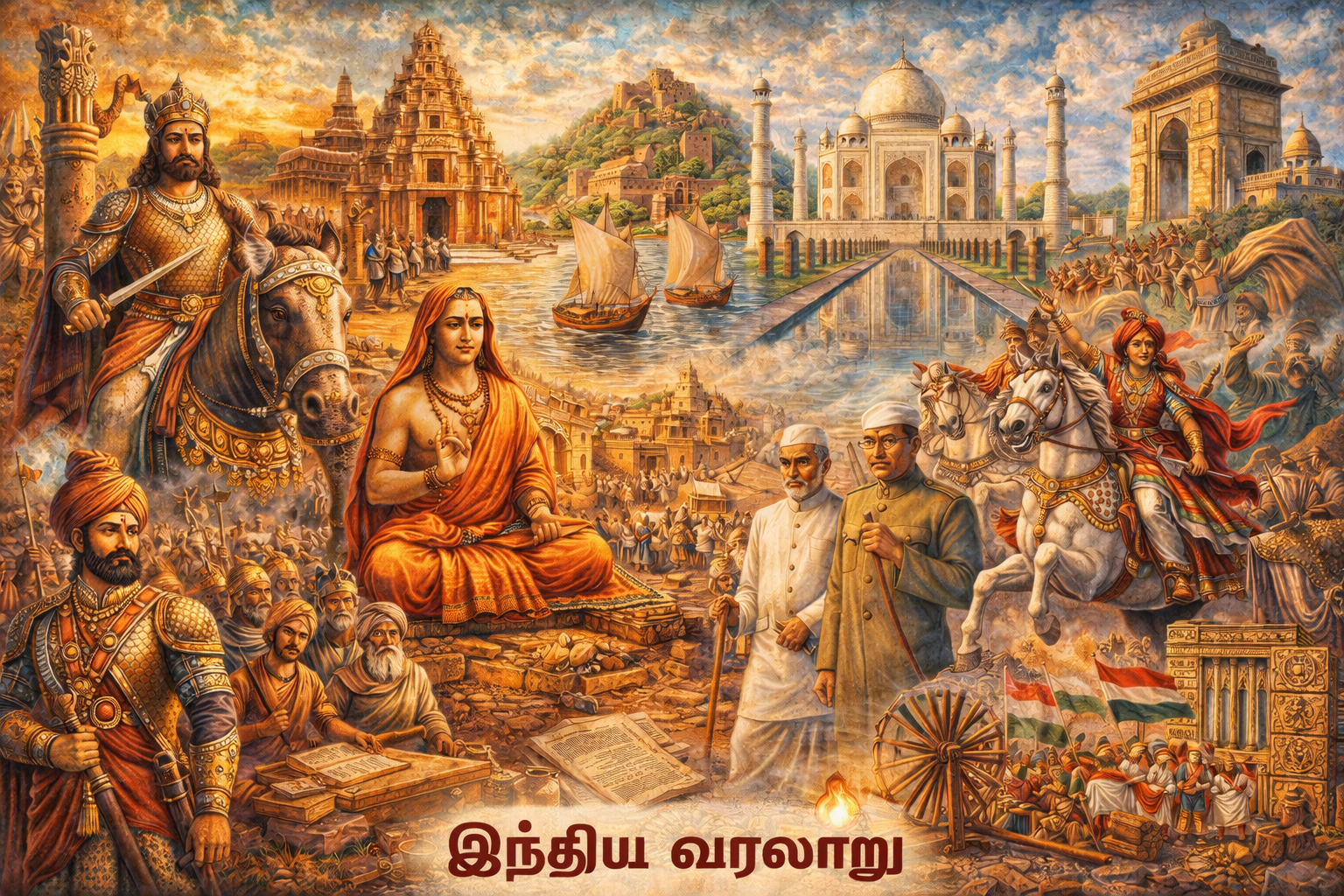
தலைப்பு
இந்தியாவின் புவியிடம்
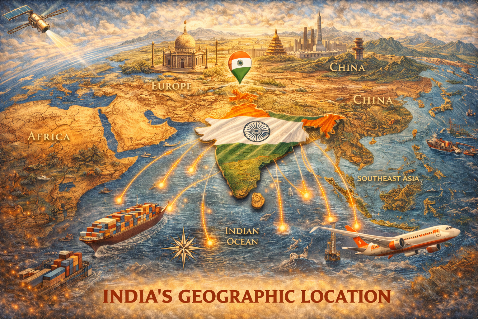
🌏 இந்தியாவின் புவியிடம் (Location of India) – முழு விளக்கம்
இந்தியா தென் ஆசியாவில் (South Asia) அமைந்துள்ள ஒரு பெரிய நாடாகும். அதன் புவியியல் அமைப்பு மற்றும் இடம் உலக வர்த்தகம், காலநிலை மற்றும் கலாச்சார வளர்ச்சிக்கு முக்கிய பங்கு வகிக்கிறது.
📍 நில அமைவு (Latitudinal & Longitudinal Extent)
- ✔ அகலாங்கு (Latitude): 8°4' வட அகலம் முதல் 37°6' வட அகலம் வரை
- ✔ தொட்டாங்கு (Longitude): 68°7' கிழக்கு தொட்டாங்கு முதல் 97°25' கிழக்கு தொட்டாங்கு வரை
🗺️ புவியியல் அமைவு
- ✔ இந்தியா ஆசியக் கண்டத்தின் தெற்கு பகுதியில் அமைந்துள்ளது
- ✔ இந்தியா இந்தியப் பெருங்கடலால் சூழப்பட்டுள்ளது
- ✔ வடக்கில் – இமயமலை (Himalayas)
- ✔ தெற்கில் – இந்தியப் பெருங்கடல் (Indian Ocean)
- ✔ கிழக்கில் – வங்காள விரிகுடா (Bay of Bengal)
- ✔ மேற்கில் – அரபிக்கடல் (Arabian Sea)
🌍 அண்டை நாடுகள் (Neighbouring Countries)
- ✔ வடமேற்கு – பாகிஸ்தான், ஆப்கானிஸ்தான்
- ✔ வடக்கு – சீனா (China), நேபாளம் (Nepal), பூடான் (Bhutan)
- ✔ கிழக்கு – மியான்மார் (Myanmar), பங்களாதேஷ் (Bangladesh)
- ✔ தெற்கு – இலங்கை (Sri Lanka)
⏰ இந்திய நிலையான நேரம் (IST)
- ✔ 82°30' கிழக்கு தொட்டாங்கு (Allahabad அருகில்)
- ✔ இந்தியா முழுவதும் ஒரே நேரம் (IST) பயன்படுத்தப்படுகிறது
🌏 முக்கியத்துவம்
- ✔ உலக வர்த்தகத்திற்கு ஏற்ற இடம்
- ✔ பல்வேறு காலநிலை மண்டலங்கள்
- ✔ இயற்கை வளங்கள் நிறைந்த நாடு
- ✔ கலாச்சார மற்றும் பொருளாதார வளர்ச்சிக்கு உதவுகிறது
முக்கிய குறிப்புகள் (TNPSC):
- ✔ Latitude – 8°4'N to 37°6'N
- ✔ Longitude – 68°7'E to 97°25'E
- ✔ IST – 82°30'E
- ✔ India – South Asia
TNPSC தேர்வுகளில் “இந்தியாவின் புவியிடம் என்ன?”, “அகலாங்கு, தொட்டாங்கு என்ன?” போன்ற கேள்விகள் அடிக்கடி கேட்கப்படுகின்றன.
🌍 அச்சரேகை (Latitude) – முழு விளக்கம்
அச்சரேகை (Latitude) என்பது பூமியின் மேற்பரப்பில் கிழக்கு-மேற்கு திசையில் சுற்றி வரையப்பட்ட கற்பனை கோடுகளாகும். இவை ஒரு இடத்தின் வடக்கு அல்லது தெற்கு நிலையை (position) அளவிட பயன்படுகின்றன.
📌 வரையறை
பூமியின் மையத்தில் இருந்து அளக்கப்படும் வடக்கு மற்றும் தெற்கு தூரத்தை டிகிரி (degree) அளவில் காட்டும் கோடுகளே அச்சரேகைகள் ஆகும்.
📏 முக்கிய அம்சங்கள்
- ✔ 0° முதல் 90° வரை வடக்கு மற்றும் தெற்கு திசையில் இருக்கும்
- ✔ Equator (0°) முக்கிய அச்சரேகை
- ✔ எல்லா அச்சரேகைகளும் ஒரே நீளத்தில் இருக்காது
- ✔ வடக்கு (N) மற்றும் தெற்கு (S) என குறிக்கப்படும்
🌐 முக்கிய அச்சரேகைகள்
- ✔ 0° – பூமத்திய ரேகை (Equator)
- ✔ 23½° N – கடகரேகை (Tropic of Cancer)
- ✔ 23½° S – மகர ரேகை (Tropic of Capricorn)
- ✔ 66½° N – ஆர்க்டிக் வட்டம் (Arctic Circle)
- ✔ 66½° S – அண்டார்டிக் வட்டம் (Antarctic Circle)
🇮🇳 இந்தியாவில் அச்சரேகை
- ✔ கடகரேகை (23½° N) இந்தியாவை கடந்து செல்கிறது
- ✔ இது இந்தியாவை வெப்பமண்டல மற்றும் உஷ்ணமண்டல பகுதிகளாகப் பிரிக்கிறது
🌏 முக்கியத்துவம்
- ✔ காலநிலை (Climate) தீர்மானிக்க உதவும்
- ✔ பகல்-இரவு நேர மாற்றங்களை புரிய உதவும்
- ✔ வரைபடங்களில் இடத்தை கண்டறிய உதவும்
முக்கிய குறிப்புகள் (TNPSC):
- ✔ Latitude = North-South position
- ✔ 0° – Equator
- ✔ Tropic of Cancer passes India
- ✔ Range – 0° to 90°
TNPSC தேர்வுகளில் “அச்சரேகை என்றால் என்ன?”, “Equator என்ன?”, “Tropic of Cancer எங்கு செல்கிறது?” போன்ற கேள்விகள் அடிக்கடி கேட்கப்படுகின்றன.
🌐 தீர்க்கரேகை (Longitude) – முழு விளக்கம்
தீர்க்கரேகை (Longitude) என்பது பூமியின் மேற்பரப்பில் வடக்கு துருவத்திலிருந்து தெற்கு துருவம் வரை செல்லும் கற்பனை கோடுகளாகும். இவை ஒரு இடத்தின் கிழக்கு அல்லது மேற்கு நிலையை (position) அளவிட பயன்படுகின்றன.
📌 வரையறை
பூமியின் மையத்தில் இருந்து கிழக்கு மற்றும் மேற்கு திசையில் அளக்கப்படும் தூரத்தை டிகிரி (degree) அளவில் காட்டும் கோடுகளே தீர்க்கரேகைகள் ஆகும்.
📏 முக்கிய அம்சங்கள்
- ✔ 0° முதல் 180° வரை கிழக்கு (E) மற்றும் மேற்கு (W) திசையில் இருக்கும்
- ✔ எல்லா தீர்க்கரேகைகளும் ஒரே நீளத்தில் இருக்கும்
- ✔ வட துருவம் முதல் தென் துருவம் வரை செல்லும்
- ✔ நேரத்தை கணக்கிட பயன்படும்
🌍 முக்கிய தீர்க்கரேகை
- ✔ 0° – கிரீன்விச் பிரதான தீர்க்கரேகை (Prime Meridian – Greenwich)
🇮🇳 இந்தியாவில் தீர்க்கரேகை
- ✔ 82°30' கிழக்கு தீர்க்கரேகை இந்திய நிலையான நேரத்திற்கு அடிப்படை
- ✔ இது அலஹாபாத் (Prayagraj) அருகில் செல்கிறது
- ✔ இந்தியா முழுவதும் ஒரே நேரம் (IST) பயன்படுத்தப்படுகிறது
⏰ முக்கியத்துவம்
- ✔ நேரத்தை (Time) கணக்கிட உதவும்
- ✔ உலக நேர மண்டலங்களை (Time Zones) தீர்மானிக்க உதவும்
- ✔ வரைபடங்களில் இடத்தை கண்டறிய உதவும்
முக்கிய குறிப்புகள் (TNPSC):
- ✔ Longitude = East-West position
- ✔ 0° – Prime Meridian
- ✔ Range – 0° to 180°
- ✔ IST – 82°30' E
TNPSC தேர்வுகளில் “தீர்க்கரேகை என்றால் என்ன?”, “Prime Meridian என்ன?”, “IST எப்படி கணக்கிடப்படுகிறது?” போன்ற கேள்விகள் அடிக்கடி கேட்கப்படுகின்றன.
🌍 முக்கிய புவியியல் கோடுகள் (Important Geographical Lines) – முழு விளக்கம்
பூமியின் மேற்பரப்பில் கற்பனை கோடுகளாக வரையப்பட்டுள்ள சில முக்கிய கோடுகள் புவியியல் மற்றும் காலநிலை புரிதலுக்கு மிகவும் அவசியமானவை. இவை உலகத்தை பல பகுதிகளாகப் பிரித்து, வெப்பநிலை, பருவநிலை மற்றும் பகல்-இரவு மாற்றங்களை விளக்க உதவுகின்றன.
📌 முக்கிய புவியியல் கோடுகள்
| கோடு | அட்சரேகை (Degree) | முக்கியத்துவம் |
|---|---|---|
| பூமத்திய ரேகை (Equator) | 0° | பூமியை வடக்கு மற்றும் தெற்கு அரைக்கோளங்களாகப் பிரிக்கிறது |
| கடகரேகை (Tropic of Cancer) | 23½° N | இந்தியாவை கடக்கும் முக்கிய கோடு |
| மகர ரேகை (Tropic of Capricorn) | 23½° S | தெற்கு அரைக்கோளத்தில் வெப்ப மண்டல எல்லை |
| ஆர்க்டிக் வட்டம் (Arctic Circle) | 66½° N | Polar Region தொடக்கம் |
| அண்டார்டிக் வட்டம் (Antarctic Circle) | 66½° S | தெற்கு துருவ பகுதி |
| கிரீன்விச் தீர்க்கரேகை (Prime Meridian) | 0° Longitude | உலக நேரத்தின் அடிப்படை |
📘 விரிவான விளக்கம்
1️⃣ பூமத்திய ரேகை (Equator)
- ✔ 0° அகலாங்கு
- ✔ பூமியை இரு சமமான பகுதிகளாகப் பிரிக்கிறது
- ✔ அதிக வெப்பம் காணப்படும் பகுதி
2️⃣ கடகரேகை (Tropic of Cancer)
- ✔ 23½° வட அகலாங்கு
- ✔ இந்தியாவை கடக்கும் முக்கிய கோடு
- ✔ வெப்ப மண்டலத்தின் வட எல்லை
3️⃣ மகர ரேகை (Tropic of Capricorn)
- ✔ 23½° தென் அகலாங்கு
- ✔ வெப்ப மண்டலத்தின் தெற்கு எல்லை
4️⃣ ஆர்க்டிக் வட்டம் (Arctic Circle)
- ✔ 66½° வட அகலாங்கு
- ✔ Polar Region தொடக்கம்
- ✔ 6 மாதம் பகல்/இரவு காணப்படும் பகுதி
5️⃣ அண்டார்டிக் வட்டம் (Antarctic Circle)
- ✔ 66½° தென் அகலாங்கு
- ✔ தெற்கு துருவ பகுதி
6️⃣ கிரீன்விச் தீர்க்கரேகை (Prime Meridian)
- ✔ 0° தீர்க்கரேகை
- ✔ உலக நேரத்தின் அடிப்படை (GMT)
- ✔ கிழக்கு மற்றும் மேற்கு அரைக்கோளங்களைப் பிரிக்கிறது
🌏 முக்கியத்துவம்
- ✔ காலநிலை மற்றும் பருவநிலை புரிதல்
- ✔ நேர கணக்கீடு
- ✔ உலகத்தை பிரித்து ஆய்வு செய்ய உதவும்
முக்கிய குறிப்புகள் (TNPSC):
- ✔ Equator – 0°
- ✔ Tropic of Cancer – 23½° N (India)
- ✔ Tropic of Capricorn – 23½° S
- ✔ Arctic – 66½° N
- ✔ Antarctic – 66½° S
- ✔ Prime Meridian – 0° Longitude
TNPSC தேர்வுகளில் “முக்கிய புவியியல் கோடுகள் என்ன?” “Tropic of Cancer எங்கு செல்கிறது?” போன்ற கேள்விகள் அடிக்கடி கேட்கப்படுகின்றன.
⏰ நேரம் கணக்கீடு & இந்தியா (Time Calculation & India) – முழு விளக்கம்
பூமி தனது அச்சு சுற்றுவதால் (Rotation), வெவ்வேறு பகுதிகளில் வெவ்வேறு நேரங்கள் காணப்படுகின்றன. இதை சரியாக நிர்ணயிக்க தீர்க்கரேகைகள் (Longitudes) மற்றும் நேர மண்டலங்கள் (Time Zones) பயன்படுத்தப்படுகின்றன.
🌍 நேரம் கணக்கீட்டின் அடிப்படை
- ✔ பூமி 24 மணி நேரத்தில் 360° சுழலும்
- ✔ 1 மணி நேரம் = 15°
- ✔ 1° = 4 நிமிடம்
📌 கிரீன்விச் நேரம் (GMT)
- ✔ 0° தீர்க்கரேகை (Prime Meridian – Greenwich)
- ✔ உலக நேரத்தின் அடிப்படை
- ✔ எல்லா நாடுகளும் GMT அடிப்படையில் நேரம் கணக்கிடுகின்றன
🇮🇳 இந்திய நிலையான நேரம் (IST)
- ✔ 82°30' கிழக்கு தீர்க்கரேகை அடிப்படையாகும்
- ✔ அலஹாபாத் (Prayagraj) அருகே செல்கிறது
- ✔ GMT + 5 மணி 30 நிமிடம்
🧮 நேரம் கணக்கிடும் முறை
Formula:
நேர வேறுபாடு = (தீர்க்கரேகை வேறுபாடு × 4 நிமிடம்)
📍 உதாரணம்
- ✔ இடம் A – 0°
- ✔ இடம் B – 30° கிழக்கு
- ✔ வேறுபாடு = 30 × 4 = 120 நிமிடம் = 2 மணி
👉 அதாவது 30° கிழக்கு இடம், GMT-யை விட 2 மணி முன்னதாக இருக்கும்.
🌏 இந்தியாவில் ஒரே நேரம் ஏன்?
- ✔ இந்தியா கிழக்கு முதல் மேற்கு வரை பரவலாக உள்ளது
- ✔ பல நேர மண்டலங்கள் இருக்கலாம்
- ✔ ஆனால் நிர்வாக வசதிக்காக ஒரே IST பயன்படுத்தப்படுகிறது
⚠️ முக்கிய குறிப்புகள்
- ✔ கிழக்கு செல்லும்போது நேரம் அதிகரிக்கும்
- ✔ மேற்கு செல்லும்போது நேரம் குறையும்
முக்கிய குறிப்புகள் (TNPSC):
- ✔ 1° = 4 minutes
- ✔ 15° = 1 hour
- ✔ IST = 82°30' E
- ✔ IST = GMT + 5:30
TNPSC தேர்வுகளில் “நேரம் எப்படி கணக்கிடப்படுகிறது?”, “IST என்ன?”, “1°க்கு எத்தனை நிமிடம்?” போன்ற கேள்விகள் அடிக்கடி கேட்கப்படுகின்றன.
மக்கள் கேட்கும் கேள்விகள்
உங்களுக்கான முக்கிய பதில்கள்
ஆசியா (Asia)
8°4′ N முதல் 37°6′ N வரை
68°7′ E முதல் 97°25′ E வரை
இந்திரா பாயிண்ட்
ஹிமாலய மலைத்தொடர்
சுமார் 3.28 மில்லியன் சதுர கிலோமீட்டர்
கற்கடக ரேகை (Tropic of Cancer)
82°30′ கிழக்கு (Indian Standard Time)
வடக்கு மற்றும் கிழக்கு அரைக்கோளங்களில்
ஆசியாவின் மையப்பகுதியில் இருப்பதால் வர்த்தகம் மற்றும் கலாச்சார பரிமாற்றத்திற்கு முக்கியமானது